

Services
I can provide you with a range of professional drone services. With more than 20 years of manned aviation supporting my work and now in my 8th year of operating a drone I have both the experience and the ideas to provide you with the imagery you need to achieve effective results.
Stills
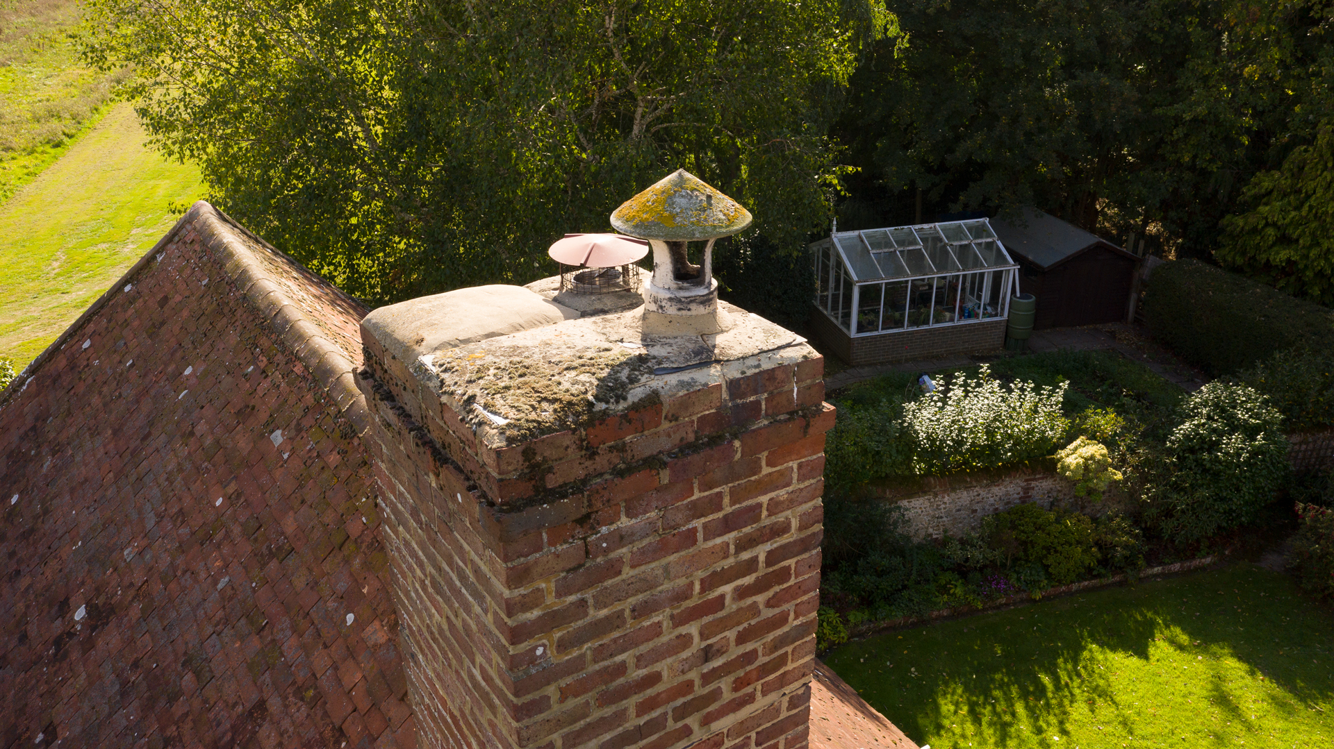
If you have concerns over roofs or objects at height then I’m able to provide shots that show the detail you require to allow a professional assessment of the situation, in many cases high resolution images will negate the need for a cherry-picker and lower the H&S risks.
I’m able to provide you or your estate agent with high resolution images that capture the beauty of your property. Show your potential buyer the whole picture.
Video
https://vimeo.com/507878139
Do you need an establishing shot for your project? do you need to show the relationship between spaces. Aerial footage is able to provide the quality coverage that your project needs. The “drone shot” is no longer a novelty, it’s become a valuable tool in the filmmakers arsenal as it helps you to tell your story.
Specialist Work
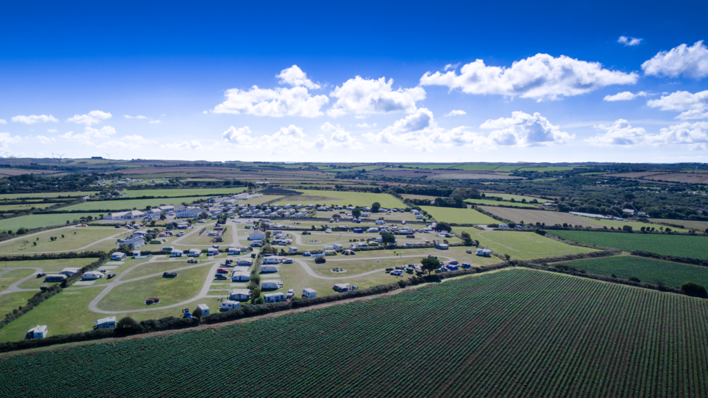
Do you need to create maps which can be posted around a holiday campsite as well as being printed out. I’m able to create scalable images which look epic at any size whether they fit on an A3 sheet or are printed at A0 size.
Do you need to calculate the volume of an object or earth bank? I can use the drone to create a “point cloud” which then allows us to make the calculations as well as create objects to be created in 3D.
360 Panoramas and Tours
With the advent of better software, better broadband download speeds and more consistent browser support for immersive video or VR we have reached the point where a significant number of sites could benefit from using either individual 360 panoramic images or the creation of a full tour.
I can provide quality aerial 360 imagery. Dependant on interest levels, I’ll be looking at the provision of higher quality ground based 360 degree imagery.
If this is an area that interests you or your organisation then please contact me using any of the means at the bottom of the page.
Many plug ins are now available which allow you to add some form of 360 imagery to your website, whether or not you are using something like WordPress with Elementor or similar. The example shown taken above Tehidy Park Golf Club in Cornwall is the simplest format available – if you need labelling then generally you will find that a small fee is payable to the provider of the software. Either one off payments or small subscriptions yearly.
Panoramas
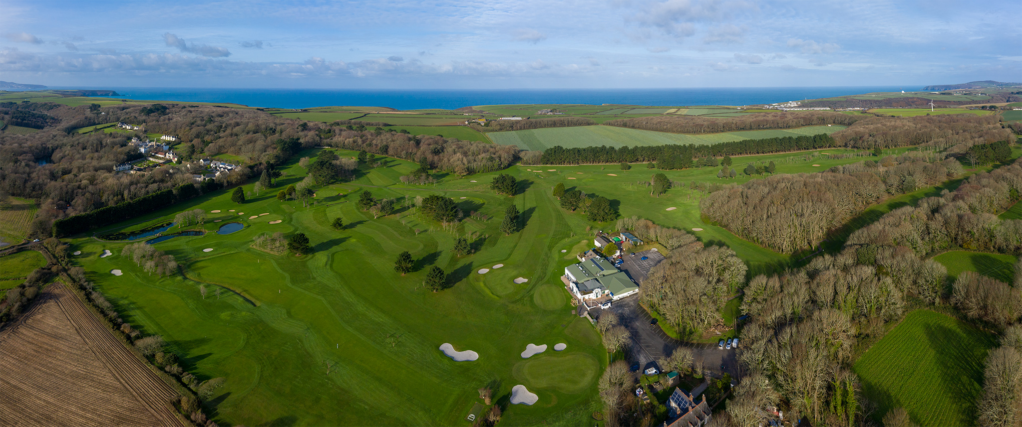
If you need a BIG image that provides a breathtaking aerial perspective I’m able to stitch images together to show a truly vast area. The image above is generated from around 27 images and shows Tehidy Park Golf Club and the North Cornish coastline, from St Ives just visible on the far left via Godrevy to St Agnes Beacon, on the far right . The image itself is over 13,000 pixels wide.
Contact Me
My name is Simon Willson, I’m based in Truro and while I normally operate across Devon and Cornwall I’m more than happy to travel.
As an examiner for a Civilian Aviation Authority (CAA) Recognised Assessment Entity (RAE) ie a ‘Drone school’, I have links with many professional drone operators across the UK and may be able to provide contact numbers depending on your requirement.
Ops@DroneBorneImaging.com
+44 (0)7968 525547

I now operate in the Open category.
My Operator ID is GBR-OP-CG3MFSLLTYNV.

![]()
Whenever I operate commercially I wilI hold Public Liability Insurance Cover that is fully compliant with EU regulation EC785/2004.
Copyright © Drone Borne Imaging 2016 – 2024